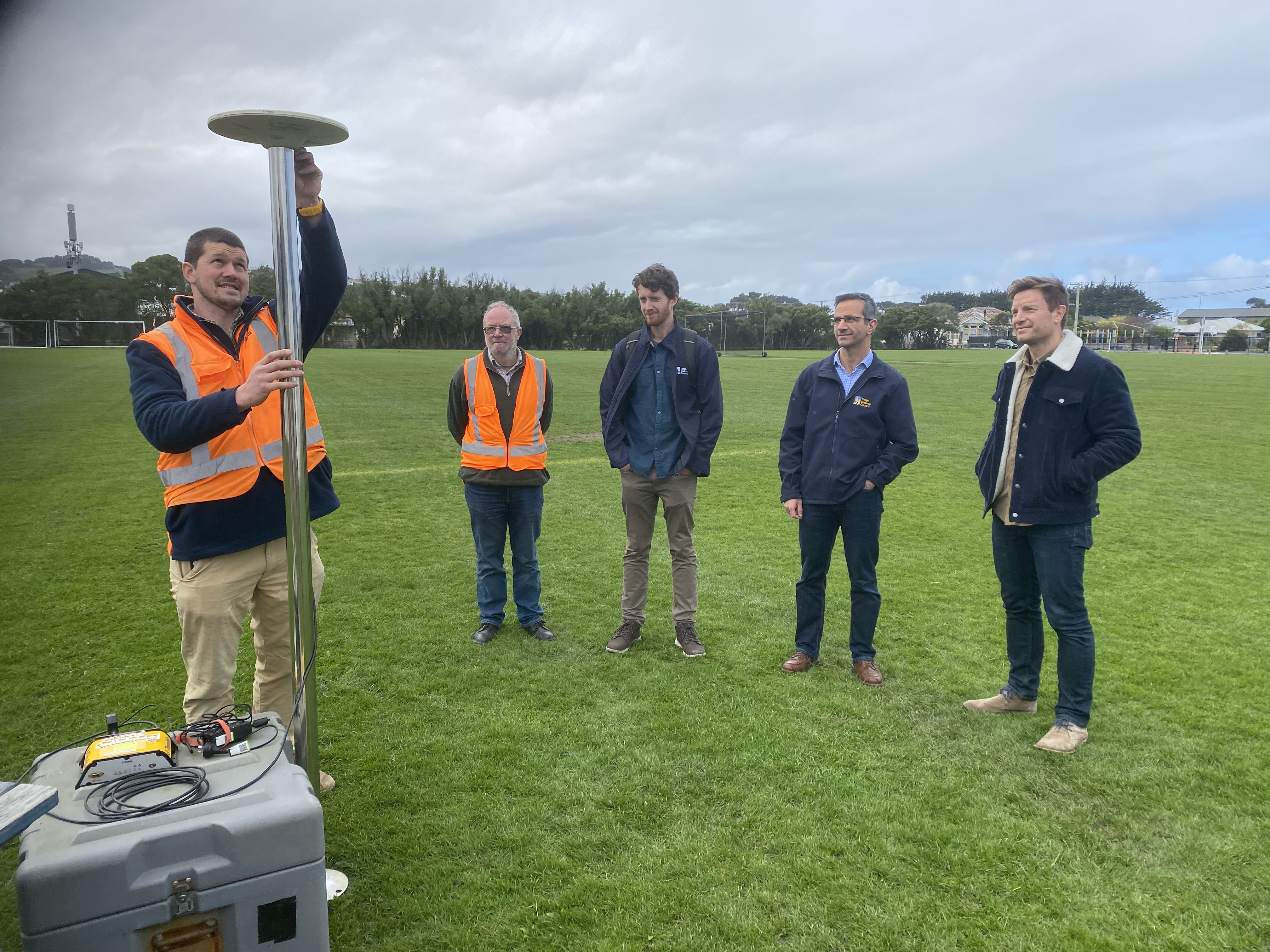
GPS instruments, used to measure vertical land movement, are being installed by the ORC and the University of Otago School of Surveying at five sites around South Dunedin, to find out how quickly the land surface is rising or sinking.
Previous estimates of the land movement have relied on satellite data, but the GPS equipment is capable of more accurate measurements, down to the millimetre.
ORC Manager Natural Hazards, Dr Jean-Luc Payan, says the impact of local sea-level rise is affected by the up and down movements of the land.
“Knowing where and the rate of land subsidence will assist in better understanding the rate of effective sea level rise for South Dunedin.”
“When we combine this with other information, such as groundwater monitoring and what we know about hazards such as erosion and coastal flooding, we get a clearer picture of what the future could hold,” he says.
On Friday, 13 September, reporters are invited to Culling Park (details below), where ORC staff can explain the monitoring equipment and how data is collated.
The monitoring focuses on the surface of ground above bedrock which for parts of South Dunedin – once a coastal wetland - was reclaimed and is mainly loose sediment. Five monitoring sites are being set up across an area of approximately 2 km2 to capture an average rate of ground movement and to help identify any differences in movement across South Dunedin.
This local information will assist in confirming, at the local South Dunedin scale, the information released in 2023 by the NZ SeaRise: Te Tai Pari O Aotearoa programme.
The University of Otago’s School of Surveying is assisting with the project. Installation of instruments will be overseen by a specialist in surveying, Dr Paul Denys.
The monitoring equipment, each attached to an antenna pole, will continuously receive information from global navigation satellite systems. This allows the antennas to calculate its vertical position very precisely – down to the millimetre. Over time this data will reveal an accurate trend in land movement.
“If the ground is subsiding by even few millimetres a year, you’d want to know about it. Over time this can be significant and can compound the effects of sea level rise which could be felt sooner than expected,” says ORC’s Dr Payan.
It will be at least two years before there’s enough data to give an accurate picture of where and what subsidence could happen in South Dunedin in the years ahead. The monitoring programme will run for at least five years.
South Dunedin Future Programme Manager Jonathan Rowe says the information will be very valuable.
“It helps to build a detailed picture of what’s really happening in South Dunedin and make the right adaptation plan for the area’s future.”
Equipment demonstration
Where: Culling Park, Royal Cres (meet outside Albion Cricket Club)
When: 13 September
Time: 12-12:30pm.
What: Explanation of monitoring equipment and data gathering